The Eye of the Sandias
December 2, 2005
I don't remember if I have mentioned it or not in this diary, but I love living in New Mexico.
Have I said that before?
Yesterday in Michigan it was cold and overcast and snowing. In the northern part of the state my parents got a foot of snow.
Now granted, colder weather is on the way, but the lure of a walk in the wilderness when the temp was a balmy 60 degrees was just too much to resist.
Yeah, I know, I should be studying. But then as some folks know, I like 2fers. Multitasking. You know, sitting in class and surfing the web.
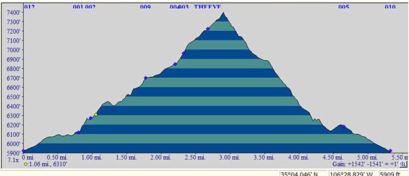
Anyhow, during my 3 and a half hour hike I did get through 3 hours of Contracts review, which made our "live" review on campus this morning all the more worthwile.
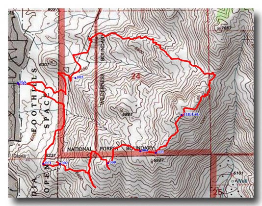
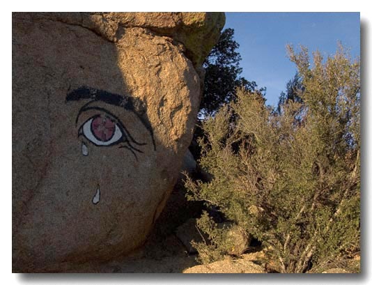
I set off to find what is known as the "Eye of the Sandias."
As you can see, I walked up a bunch, and down a bunch.
And if you look at the bottom of the map you can see two red lines that kind of go off and stop. Those would be dead ends, trails that led off to the right and poof, stopped.
As I was walking back from the first dead end I ran into a couple who were also looking for the "Eye." I told them that I was on the wrong trail and I knew it by checking my gps. I also told them I had the course plotted out. The woman of the two decided that it was going to be full steam ahead and she charged off ahead of me. Not long after, we found ourselves again, down a short wrong path. They saw me and I retreated and rejoined the path.
I looked back and never saw them again.
That was a long way to hike and not get to the finish line.
The way she stormed past me I kind of got the drift that she was thinking something along the lines of "who the F needs men anyway."
Well, you may not need a man sister, but you sure as hell could have used my GPS.
They never made it to the Eye. But then again, it was another 600 feet uphill to get there.
Maybe they were the smarter ones.
The eye first showed up sometime in the 1960's and was then repainted in 2002. Local legend states that the Eye represents sadness over the encroachment of the city on the mountain.
After a short rest and a change of CD's for my review, I decided to see if I could do a 3fer - and combine this hike with another that just a short distance away. There was no official connecting trail between the two, but sure enough, some people had worn a path headed on over to the second route down the mountain.
As you can see, it was starting to get late, and I still had a little over 2 and a half miles to go.
I found a way down a rather significant boulder field and set out down the mountain.
By the way, remember, that in many ways, it's harder to go downhill than up. Sure you don't have the exertion, but have the slipping and sliding and your legs are not at all used to all that downhill muscle contraction.
That's one of the reasons that if you run into me on the trail, you'll note that I always hike with two hiking poles. They are the greatest, especially on a steep downhill grade.
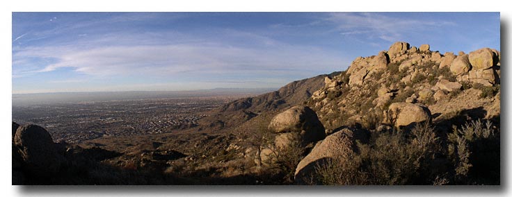
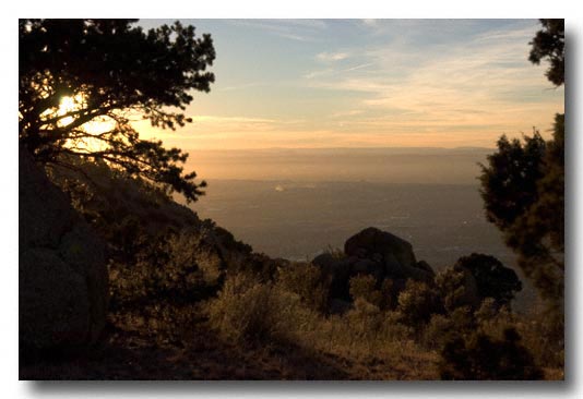
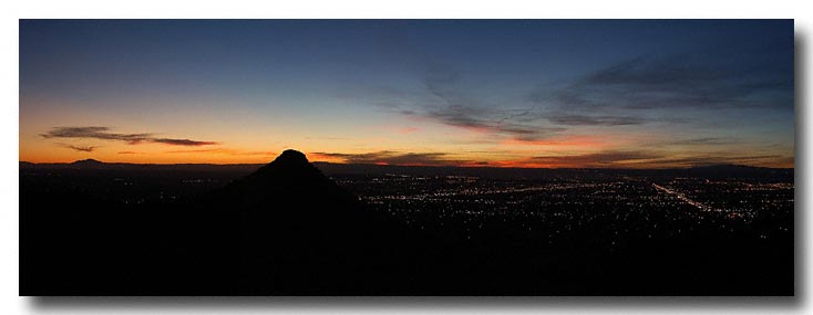
Still a mile or so from the car, I took a break to just sit and look over the city.
It's a great time of day to be perched above the city.