
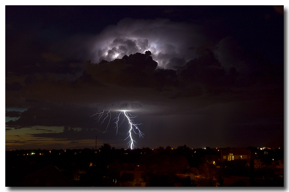
This was a great day for me. I’ve been on the road so much these last two years that I’ve missed lots and lots of the summer storms here in Albuquerque. Tonight however, I got to watch and shoot during an amazing display. I love it when the clouds are defined by a really bright strike. The problem is however, that if the strike is really bright, then it can overpower the image and the strike is “blown out” because of it’s intensity.

This first shot of the series, and one of the most dramatic, was almost ruined by the fact that I didn’t hold down the lens strap and it ended up fluttering, because of a sudden wind gust, into the body of the image. A little cropping got rid of that aspect, and the result is this dynamic shot. When you look at the three images together you can see that the base of the storm is above the summit of the sandia peak. That means that there is at least one mile from the bottom of the cloud to the ground, and that probably means that the strike in the first image is probably 3 or 4 miles in length.
 When I get all of the series posted I’ll put in a hyperlink. I also hope to add a slideshow that plays a series of the strikes all from one vantage point.
The storm moved to the north east and because the strike is behind the ridge it is over 16 miles away.

by admin
no comments
link to this post email a friend